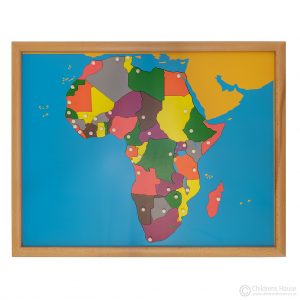
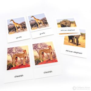
The Africa Flags – 3 Part Cards activity lists 60 countries with their individual flags. Each control card depicts a beautifully illustrated flag of the country and a map indicating where it is situated on the continent. These classified cards are aligned to the Montessori Africa Puzzle Map and Geography curriculum.
Africa, the 2nd largest of the world’s continents, covers 1/5th of the world’s total land mass. This continent lies between the Atlantic Ocean, Mediterranean Sea, Red Sea and Indian Ocean. The Africa Flags – 3 Part Cards activity lists 60 countries with their individual flags. Each control card depicts a beautifully illustrated flag of the country and a map indicating where it is situated on the Montessori Geography continent.
Examples of the African Flags
Comoros
Mozambique
Equatorial Guinea
Rwanda
Uganda
Zambia
Sudan
Zimbabwe
Algeria
Madeira
Seychelles
Cameroon
Angola
Liberia
Somalia
South Sudan
South Africa
Senegal
Features of the Africa Flags – 3 Part Cards
vibrantly coloured, high definition images of the national flag of each country
the direct objective for the Child:
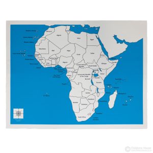
to name and find all the countries on the African continent as per the Africa Puzzle Map
indirectly, the Child develops a natural curiosity for other cultures, and an interest to learn more
I far prefer the cards to the actual flags, which are far more expensive and take up so much space in the class. The flags are up to date, which is always great.
I far prefer the cards to the actual flags, which are far more expensive and take up so much space in the class. The flags are up to date, which is always great.


Tiffany2 (verified owner) –
I far prefer the cards to the actual flags, which are far more expensive and take up so much space in the class. The flags are up to date, which is always great.